
Mountain weather
Peak District Mountain weather forecast table
Confidence
High for a bright but showery theme in coming days. Moderate for shower details and extent of low cloud each night and early morning.
Mountain weather hazards
Hazards apply at or above 300m, reflecting the more severe conditions which can occur at altitude.
 Poor Visibility
Poor visibility presents challenging route finding conditions. Visibility could be significantly less than 50 metres in all directions with few or no visual references, especially on featureless moors or plateaux. Distances become hard to judge and cliff or cornice edges can be difficult to recognise. These conditions require good navigational skills. There is a risk of white-out conditions when mist or fog is combined with extensive snow cover.
Thunderstorms
Lightning is a significant mountain hazard which can result in serious injury or death. Mountain terrain often leaves one highly exposed to lightning strikes. Hail may give unpleasant conditions with torrential rain and localised flash flooding also possible, mainly in Summer months.
Strong Sunlight
Harmful UV levels from sunlight increase with altitude giving a greater risk of sunburn and eye damage, even on some overcast days. On breezy days, the cooling effect of wind on exposed skin may disguise any feeling of sunburn until it is too late. If there is snow cover, glare increases the effect of UV rays especially on the eyes. It is advisable to wear sun block, protective clothing such as a long-sleeved top and hat and have good quality eye protection.
Mountain weather forecast
Early low cloud clearing to sunny spells and showers later.
| 06:00 | 09:00 | 12:00 | 15:00 | 18:00 | 21:00 | |
|---|---|---|---|---|---|---|
Weather (at 600m) |
|
|
|
|
|
|
Chance of precipitation (at 600m) |
<05% | 20% | 40% | 30% | 10% | 10% |
Wind direction and speed (mph)
Altitude above mean sea level
| 06:00 | 09:00 | 12:00 | 15:00 | 18:00 | 21:00 | |
|---|---|---|---|---|---|---|
| 600m |
NE
10
|
NE
13
|
NE
14
|
NE
14
|
NE
15
|
NE
12
|
| 300m |
NE
9
|
NE
9
|
NE
10
|
NE
10
|
NE
11
|
NE
9
|
| Valley |
NE
4
|
NE
5
|
NE
7
|
NE
8
|
NE
9
|
NE
8
|
Wind gust (mph)
Altitude above mean sea level
| 06:00 | 09:00 | 12:00 | 15:00 | 18:00 | 21:00 | |
|---|---|---|---|---|---|---|
| 600m | 13 | 17 | 20 | 20 | 21 | 19 |
| 300m | 12 | 12 | 16 | 16 | 17 | 16 |
| Valley | 10 | 9 | 15 | 16 | 18 | 20 |
Altitude above mean sea level
| 06:00 | 09:00 | 12:00 | 15:00 | 18:00 | 21:00 | |
|---|---|---|---|---|---|---|
| 600m |
10°
|
11°
|
13°
|
16°
|
14°
|
10°
|
| 300m |
12°
|
14°
|
16°
|
18°
|
17°
|
13°
|
| Valley |
13°
|
15°
|
17°
|
20°
|
18°
|
13°
|
| Freezing Level |
2,500m
|
2,500m
|
2,600m
|
2,300m
|
2,100m
|
2,100m
|
Altitude above mean sea level
| 06:00 | 09:00 | 12:00 | 15:00 | 18:00 | 21:00 | |
|---|---|---|---|---|---|---|
| 600m |
7°
|
8°
|
11°
|
13°
|
12°
|
8°
|
| 300m |
10°
|
12°
|
14°
|
16°
|
15°
|
11°
|
| Valley |
13°
|
15°
|
16°
|
18°
|
16°
|
12°
|
Additional weather information
Meteorologist's view
Hill fog may make navigation tricky if near summits around sunrise. Sun protection advised through the middle and latter part of the day.
Weather
Low cloud covering summits during the first part of the morning. Cloud lifting and breaking a little after sunrise, with sunny intervals and a chance of isolated showers, with a very low risk of thunder. Bright through the afternoon, becoming increasingly dry, with sunny intervals. Moderate UV levels expected in the long sunny spells in the afternoon.
Chance of cloud-free hill tops
30%, soon becoming 90%.
Low cloud and visibility
Cloud down to 400-500m through the early hours, soon rising to above summits in the hours after sunrise. Cloud should remain above summits even any showers later. Visibility generally poor in early cloud at elevation otherwise good or very good with clear views of distant hills. Visibility dropping to moderate in any showers.
Recent rainfall
Location: Cat & Fiddle (Midway between Buxton and Macclesfield)
Altitude: 511m
| Last 24 hours | Last 48 hours | Last 72 hours |
|---|---|---|
| 0.1mm | 4.4mm | 20mm |
Measurement date:
Rainfall data provided by the Environment Agency. The Met Office is not responsible for content provided by third parties and may remove this data without warning.
Mountain weather information
Weather
Another cloudy start, with cloud covering summits initially. Becoming bright with long sunny spells. Dry throughout. Warm with high UV levels. Cloud thickening from the east once again overnight.
Chance of cloud-free hill tops
20%, becoming 95% by mid-morning.
Maximum wind speed expected
Northeasterly 20mph.
Temperature
- At 600m Plus 5 Celsius becoming 16 Celsius.
- Valley Plus 8 Celsius becoming 18 Celsius.
- Freezing level Above summits.
Low cloud and visibility
Cloud down to 400m initially, soon lifting and breaking, with very little cloud by late morning. Visibility poor in cloud at elevation during the early hours and around sunrise, soon becoming good or very good with clear views of distant hills.
Mountain weather information
Mon 20 May
Sunrise:
Sunset:
Low cloud, mist and fog likely early and late, with plenty of bright and sunny spells through the middle of the day. Light easterly winds. Freeing level above summits.
Tue 21 May
Sunrise:
Sunset:
Another cloud start likely, through soon becoming brighter. The risk of showers increasing through the day, these may be heavy and thundery. Light and variable winds. Freezing level above summits.
Wed 22 May
Sunrise:
Sunset:
A dry start but becoming increasingly cloudy. Winds strengthening from the north. A chance of rain later. Freezing level above summits.
Updated at:
Summit specific forecast
Mountain summit forecast map
Loading map…
Key
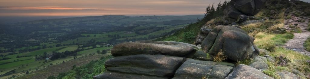
The Peak District is home to a wide variety of magnificent hills, moors, outcrops and gritstone edges.